
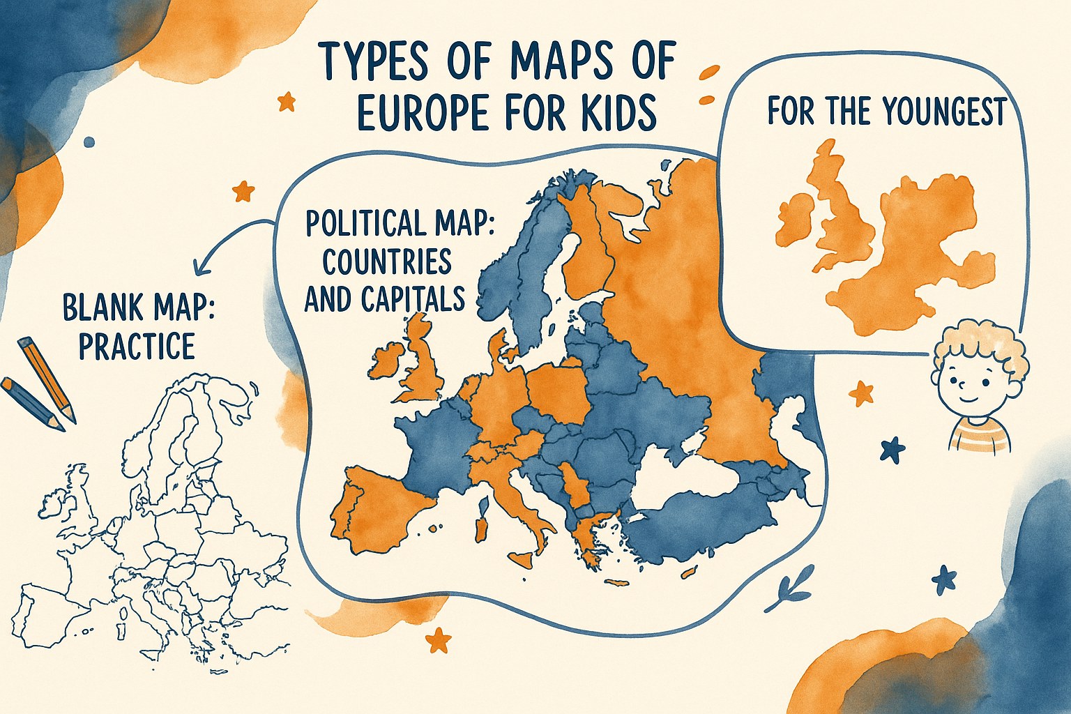
Do your children still mix up Brussels and Bratislava, and has studying geography become a source of stress at home? 🗺️ A printable map of Europe with countries and capitals turns that school challenge into a fun activity. This clear visual aid helps them memorise all the nations of the continent while having fun pinpointing Mont Blanc or the main rivers.
- Finding the right printable map of Europe for your children
- How to print your learning aids successfully
- List of European countries and their capitals in 2026
- Understanding the different facets of the European continent
- Fun ways to memorise geography without getting bored
- Extra resources to become a little expert
🗺️ Finding the right printable map of Europe for your children
Now that we understand why a good visual aid matters, let’s look at how to choose the model that fits your child’s needs perfectly.
🏛️ The political map with countries and capitals
A political map is the essential basic tool. It lets you pinpoint national borders accurately. You can spot the big cities straight away.
How readable the names are stays a key thing to look for. The capitals should be clearly visible to make reading easier. Colours help avoid mixing up neighbouring nations. It’s a major visual landmark.
The practical side matters enormously. A child remembers better thanks to strong contrasts.

🤫 The blank map for practising without cheating
The blank map is the ultimate test for learning. The child has to place each name from memory. It’s the active-recall method at its very best for making progress.
Only the outlines of the borders appear on this version. No text helps the child during their geography exercise.
Using this aid regularly helps anchor the knowledge for good. You can print several copies. That lets you proudly measure the progress made each week.
👶 Simplified versions for the youngest
You need to adapt the content for younger pupils. Stripping back the lines stops a child getting lost. Too much information kills learning at this age.
Using large fonts is strongly recommended. The letters then become easy to read. Avoid geographical details that are too complex or simply minor.
Focusing on the main countries is plenty to begin with. The key thing is to understand the overall shape of the continent.
🖨️ How to print your learning aids successfully
Once you’ve picked your model, the printed result still needs to be up to scratch to stay usable on a desk.

📄 Choosing the right size between A4 and A3
A4 stays the go-to size for filing lessons in a standard binder. It’s easy for little hands to handle. Yet A3 offers far better visual comfort.
Go for the bigger size for a wall display in the bedroom. The child sees their map every day without any effort. This passive visual soaking-in turns out to be brilliant for remembering where countries are.
Remember to check your settings before hitting print. Tick the “fit to printable area” option. That stops the edges of the continent or important labels from being cut off.
📑 Going for PDF for high resolution
The PDF format is a precious ally for cartographic precision. It keeps the vector lines perfectly sharp. The capital names stay readable, even the tiniest writing.
Forget JPG images, which are often too compressed. They lose clarity and go blurry when enlarged. A geographical outline needs to stay crisp to be truly useful during exercises.
Look out for good-quality teaching resources to go with your printouts. Precision is the key to successful learning.
♻️ Tips for cheap, eco-friendly printing
Switch on draft mode for the early practice stages. This trick saves a lot of black ink. It’s the perfect solution for aids meant to be thrown away quickly.
Laminating turns a simple sheet into a long-lasting tool. Then use a wipe-clean marker to fill in the country names. Your map becomes reusable over and over for revision.
Black-and-white printing is also a great option. It turns the geography session into a fun colouring activity.
🏛️ List of European countries and their capitals in 2026
To go with your printouts, here’s an essential text summary for checking your little geographers’ answers.
🇪🇺 The members of the European Union
France, Germany and Italy are historic pillars. Croatia joined this group more recently. These nations form the current political heart of the European continent.
Here are a few must-know capitals:
- France: Paris
- Germany: Berlin
- Italy: Rome
- Spain: Madrid
- Belgium: Brussels
- Croatia: Zagreb
Look for the starry logo to spot them. They often share symbols. The blue flag is a big help.
🌍 Nations outside the EU and the special cases
Some countries are in Europe without being in the Union. Switzerland and Norway are good examples. Pupils often come across them in their research.
Turkey is a truly unique case. It straddles two continents at once. It’s perfect for a quiz. And don’t forget London for the United Kingdom.
Europe isn’t limited to the borders of the European Union; it brings together more than forty nations with varied cultures.
🔍 A close look at the capitals people often confuse
Ljubljana and Bratislava often trip up beginners. Their names look very alike. You can remember Bratislava thanks to its closeness to the Danube.
The Baltic countries also call for care. Riga, Tallinn and Vilnius follow each other from north to south. Alphabetical order helps lock these names in.
Repeat these names together. The ear helps the memory. It’s a simple trick.
🇪🇺 Understanding the different facets of the European continent
Beyond names and borders, Europe is also a physical land with relief that shapes its face.
🗻 The difference between a physical and a political map
A physical map shows nature. You can see the mountains, the rivers and the plains. It’s the geography of the wild landscape.
A political map, on the other hand, traces the borders made by people. It shows how the countries are organised. Mont Blanc appears as a major landmark, the rooftop of our continent.
| Criterion | Physical map | Political map |
|---|---|---|
| What it shows | Relief / rivers | Countries / cities |
| Main colours | Green / brown | Varied colours |
| School use | Studying nature | Learning the capitals |
| Visual example | The Alps and the Danube | France and Berlin |
🧭 The five big geographical regions
Splitting Europe into logical zones helps a lot. North, South, East, West and Centre are handy blocks. It makes the whole thing easier to memorise.
Name a country for each zone. Sweden for the North, Italy for the South. These concrete examples anchor the theory in something real.
Use these blocks to create learning steps. You don’t learn it all at once, but region by region.
🌍 Placing Europe in relation to its neighbours
Spotting the natural limits of the land is essential. The Urals separate Europe from Asia in the east. The Mediterranean marks the border with Africa in the south.
Name the main surrounding seas too. The Atlantic Ocean borders the west of the continent. This matters so the child understands their place in the world.
Look up official maps of the continent to round out your printable map of Europe with countries and capitals.
🎲 Fun ways to memorise geography without getting bored
Now that we have the right tools and the basics, let’s move on to practice with stimulating games.
🧠 Visual and audio memory techniques
Create fun word associations. Italy looks like a boot, that’s a classic. Link the country’s name to an object the child knows well.
Use songs or rhymes. The rhythm helps the brain hold on to lists of capitals. It’s a very effective audio method day to day.
Draw shapes on the outlines. Turning borders into characters fires up a child’s imagination. They’ll remember the geographical shape better.
🎨 Using colouring to learn the borders
Encourage your child to colour each nation. The physical action helps fix the shape in memory. It’s a calm and very educational activity for everyone.
Use logical colour codes. Pick blue for the North and orange for the South. That creates a visual hierarchy in the pupil’s mind. It’s simple and effective.
Let the child choose their own shades. The joy of creating boosts interest in the subject.
🎯 Running a mini-quiz with the family
Set speed challenges. Who can find Berlin in under three seconds? This game turns a chore into a joyful moment of sharing.
Use riddles about monuments. Talk about the Eiffel Tower or the Colosseum. It gives meaning to the European capital names you’ve learned.
Play stays the best engine for learning without even realising it, especially for tricky subjects like geography.
📚 Extra resources to become a little expert
To go even further, let’s discover a few hands-on activities that will turn your child into a real little cartographer.
🧩 Geography puzzles to make yourself
Make a puzzle with a printed map. Simply cut out the countries along their real borders. It’s a great fine-motor-skills exercise.
Glue the sheet onto thick card. That makes the pieces sturdier and easier to handle. The game will last much longer that way.
Put Europe back together piece by piece. The child then understands how the nations fit into one another in space.
🌡️ Themed maps on climate and population
Introduce the idea of population density. Some areas are very crowded, others almost empty. Use colours to show these striking differences.
Talk about the big climate differences. Scandinavia is cold while the Mediterranean is hot. Use pictograms like suns or snowflakes. It speaks volumes to young children.
Explain that geography is also about understanding how people live according to their surroundings.
📍 Placement exercises to test your progress
Offer lists of capitals to match up. The child has to draw a line to the right country. It’s a classic exercise but always very effective.
Try dictating names onto a blank map. That’s the expert level for older pupils. It confirms the year’s learning for good.
Celebrate every success with a points system. Encouragement is the secret to steady, joyful progress.
Print your map of Europe for children quickly to turn geography into a game. Between colouring in the borders and quizzing on capitals, this visual aid guarantees lasting, fun memorisation. Give your little explorers the world at their fingertips, starting now!
❓ FAQ
🔎 Where can I find a free printable map of Europe for my child?
There are several lovely websites for this. Look around children’s craft and education sites, which offer a range of models. Some map-focused sites also provide files in JPEG and PDF, which is super handy for getting a nice crisp image before you hit print.
If you’re after something more specific on the European Union, dedicated education sites have resources made just for that. It’s perfect for mixing things up depending on your little geographer’s age.
👶 What kind of map should I choose to start learning with younger children?
For children aged 6 to 8, I’d suggest keeping it simple. A map that’s too busy risks putting them off. Choose a model that highlights the main countries like France, Germany or Italy, with nice large, readable fonts.
The ideal is a map with bright colours to clearly tell the nations apart. You can also add a few simple landmarks, like the big seas or Mont Blanc, so they start placing the relief without getting in a muddle.
🤫 How do I use a blank map to help a pupil progress?
The blank map is a bit like the ultimate test, but in a fun version! Once the countries are well memorised, give them a blank version showing only the outlines. It’s an excellent active-recall exercise for placing the capital names from memory.
You can also turn this exercise into a colouring activity. The child colours each country a different colour while saying its name out loud. It’s a gentle method that helps fix the shapes of the borders in their mind without even feeling like work.
🏛️ Which European capitals do children often confuse?
It’s true there are a few little traps! The pairs Ljubljana (Slovenia) and Bratislava (Slovakia) often get swapped at first. The Baltic countries, like Tallinn, Riga and Vilnius, are quite a test of precision too.
My little tip: use alphabetical order or make up funny word associations. By repeating the names with a certain rhythm, a bit like a song, audio memory comes to give visual memory a hand.
🗺️ What’s the difference between a physical and a political map of Europe?
That’s a very common question! To put it simply, a physical map deals with nature: it shows the mountains, the rivers like the Danube and the plains. A political map focuses on people’s work, tracing the borders and placing the cities and capitals.
For homework, the political map is often the most asked for because it helps you learn how the countries are organised. But the physical map is brilliant for understanding why the climate changes from one part of the continent to another.
