
Hunting down good-quality teaching materials without spending hours on it can feel like a real obstacle course for parents. 🌍 These printable worksheets for kids offer a free, ready-to-use solution for exploring the world from home. You’ll find complete PDF files featuring the flags of the world’s countries, their names and their capitals, turning geography into a fun moment to share. Between Montessori nomenclature and memory games, these resources promise to boost your little explorers’ curiosity while making your daily life that bit easier.
- Where can you find printable country flags by continent?
- Nomenclature cards to learn the capitals
- Focus on the European Union and world languages
- Fun activities with flags to cut out and colour
- Telling sovereign states from dependent territories
- Tips for a successful high-resolution print
🌍 Where can you find printable country flags by continent?
Now that we understand how useful visual aids are for learning, let’s explore the resources available to build a complete collection sorted by geographical area.
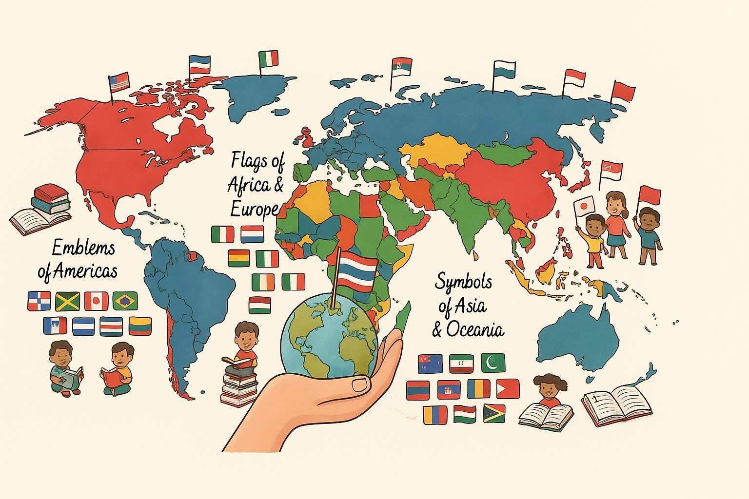
🌍 The colours of Africa and Europe
The PDF files bring together major nations like France, Germany and Nigeria. These banners are sorted by continent to make downloading easier. The materials are free and easy to find.
Telling Italy apart from Ireland takes a little care with the final colour. Italian red replaces Irish orange. Here are the types of visuals available:
- Vertical tricolour flags
- Horizontal tricolour flags
- Emblems with central symbols
Sorting really helps. The print needs to stay sharp.
🌎 The emblems of the Americas
Easily group together the flags of North, Central and South America. High-resolution visuals are on offer for Brazil or the United States. It’s perfect for a successful discovery workshop.
Use alphabetical order to file the cards. This lets children find Latin American and English-speaking countries quickly. It’s a simple trick, but such a handy one day to day.
Alphabetical filing is the first step towards a well-run map collection for school.
🌏 The symbols of Asia and Oceania
Asian nations have unique graphic features. Don’t forget the small Pacific states, often missing from standard kits despite their very original patterns. Children love these surprising designs.
Double-check that the colours are accurate before you hit print. A true-to-life paper result is essential for quality learning.
The contrasts need to be sharp. This avoids any visual confusion during memory exercises.
🏛️ Nomenclature cards to learn the capitals
Once the pictures are printed, it’s time to turn them into genuine learning tools with the Montessori method.
🌟 The Montessori format for independence
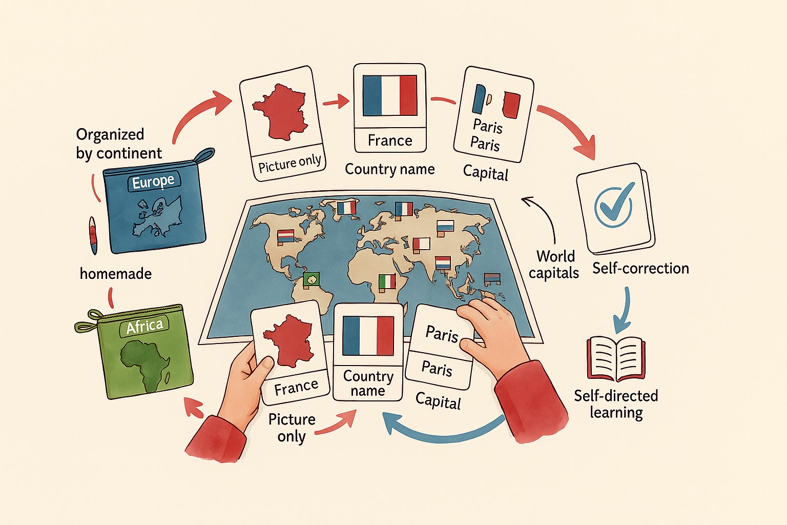
The idea rests on cards in three separate parts. This clever system encourages the child’s natural independence. The layout makes really precise cutting easy.
You can use themed storage pouches to stay organised. Each continent gets its own folder colour. It’s far simpler to find your way around quickly.
Here’s how these teaching tools are structured. Each part has a clearly defined role in learning.
| Part of the card | Teaching function |
|---|---|
| Picture only | Recognising the flag visually, without any text. |
| Name label | Identifying the country through reading. |
| Control card | Checking the picture-and-name match on your own. |
🔗 Matching the country name with its flag
All you do is make movable labels with the name written in print. Cursive works too, depending on the level. The child then matches the picture to the word.
A self-checking system on the back of the cards helps a lot. The pupil simply turns the card over to check their answer. It encourages whole-shape recognition. It’s a very effective method.
Physical handling strengthens the memory. The action goes hand in hand with the intellectual learning.
🏙️ Memorising world capitals with ease
You add the name of the main city under each picture. These simplified identity cards are perfect for schoolchildren. It enriches their general knowledge.
It’s clever to vary the difficulty levels by age. Start with neighbouring countries. Finish with the more distant nations.
You can find detailed cards for each country to round off this activity. It’s a precious resource.
🇪🇺 Focus on the European Union and world languages
Beyond the continents, certain political or linguistic groupings deserve special attention to structure your lessons.
🇪🇺 The 27 flags of the European Union
Gathering the EU members onto a single A4 sheet makes learning simpler. Each country has its own national flag. It’s an essential teaching aid for your educational cards.
Remember to include the blue flag with golden stars. The circle stands for the union of the European peoples. The number twelve evokes perfection. The history of the European flag is well worth a look for the curious.
Organisation plays a major role. The Union has around 450 million inhabitants.
🗣️ The diversity of French-speaking countries
It’s clever to pick out the nations that share the French language. You’ll find them on all five continents. Canada and French-speaking Africa come first in your choices.
Use these materials for a modern-language lesson. Pupils discover all sorts of cultures. It’s a real opening onto the world. Here are a few examples to print:
- Senegal
- Quebec
- Belgium
- Vietnam
Language becomes a bridge. The flags illustrate this linguistic kinship perfectly.
🌐 English-speaking nations around the world
Listing the Commonwealth countries and the United States adds some variety. Offering bilingual cards helps with vocabulary. English is found all over the globe.
Comparing the similarities between the flags of former colonies is an excellent exercise. You often find the Union Jack in one corner. It’s an interesting historical detail to spot.
Looking closely at the patterns helps children understand history. They love hunting for these little hidden details on the visuals.
✂️ Fun activities with flags to cut out and colour
Learning shouldn’t be a chore, so let’s turn these scraps of paper into thrilling games.
🧠 Making a homemade memory game
Print each flag twice. Use card stock for extra sturdiness. That’s the basis of a good memory game with country flags: printable worksheets for kids.
You can stick a dark sheet behind them to make the backs opaque. Lay the cards face down. Turn two over to find the matching pairs. It’s a moment to share as a family.
The game builds concentration. Children memorise the visuals effortlessly.
🖍️ Magic colouring and blank world maps
Offer flag outlines to fill in. Follow a precise colour code for each area. It’s an excellent precision exercise for budding little artists.
Provide an empty world map to complete. The children cut out and stick the labels in the right place. It builds their fine motor skills. The details can be really intricate.
The activity turns into a geography quest. They learn where countries are while having fun.
✂️ Cutting and gluing workshops for little ones
Design cards with dotted lines to guide them. The scissors should suit small hands. Cutting is a key stage in motor development.
Picture a personal travel journal. You stick in the flags met during the year. Use lolly sticks to make funny, decorative bunting.
These creations make a lovely decoration for the bedroom or the classroom. The child is proud of their handiwork.
🗺️ Telling sovereign states from dependent territories
For the most curious, it’s interesting to add some nuance about the status of the territories these banners represent.
🏛️ The official flags of the great powers
The banners of UN-recognised countries symbolise their full autonomy. Independence means the country decides on its own rules alone. It’s a simple concept for little citizens.
Filing these cards alphabetically makes searching far easier. You can also follow current diplomatic importance. A recent example of political change can be seen with the new flag flying at the UN. It’s a concrete piece of current affairs.
Sovereignty remains fundamental. Each nation proudly displays its identity.
🏝️ The special features of overseas territories
You should include the flags of non-sovereign regions in your workshops. Explain the link with the mainland. Many island and overseas regions illustrate these geographical situations perfectly.
These emblems show an incredible cultural richness. They tell a local story that is often very strong and ancient. Here are a few things to look at:
- Regional flags
- Statuses of autonomy
- Historical ties
Diversity goes beyond borders. These territories open the mind.
🤝 The banners of international organisations
Adding the logos of the UN or UNESCO is an excellent idea. These flags don’t stand for any one country. They symbolise collective worldwide action for everyone.
A bonus card on peace rounds the collection off nicely. The Red Cross is another universally recognised emblem. These symbols command respect.
The UN flag embodies the hope of peaceful cooperation between all the peoples of the Earth.
🖨️ Tips for a successful high-resolution print
To finish, let’s make sure your physical materials are as high-quality as the information they contain.
📄 Choosing between PDF, JPG and PNG formats
Go for the PDF format to keep the exact proportions of your documents. It’s the ideal choice for A4 scale. The files stay light and really easy to print.
PNG is perfect for handling transparent backgrounds if you make your own cards. Avoid pixelation by choosing a resolution of 300 DPI. The final visual quality depends hugely on it.
A blurry image spoils the learning. Always choose official, nice and sharp sources.
🏫 Tips for use in geography class
Build the flags into your morning routines with the pupils. You can present a new country each day. It really livens up the start of the day.
Offer quick recognition quizzes to stimulate visual memory. Use these cards as little rewards. They’re a brilliant aid for illustrating presentations. The children get more involved.
The playful side encourages lasting memorisation. Geography then becomes an exciting daily adventure.
📋 Recommended materials for long-lasting cards
Go for a fairly heavy paper weight. This stops tears when little hands handle the sheets. 160gsm offers a very satisfying compromise.
Laminating is still an excellent idea to protect your documents. The cards last for years despite repeated use. It’s a worthwhile investment for school equipment.
Think about eco-friendly alternatives for your inks. Recycled paper also works very well for these creative projects.
With these free printable cards, your children memorise the names, capitals and colours of the whole world while having fun. Download your PDFs quickly to turn geography into an interactive, colourful adventure. Give them this armchair journey now so they can become true little citizens of the world!
🎬 Watch the video
❓ FAQ
📥 Where can I download printable world flags as a PDF?
You can find complete, free worksheets on many educational sites. In a ‘Discovery’ section, then a ‘Geography’ subsection, PDF files bring together the banners of lots of countries with their names and capitals.
These resources are perfect for setting up workshops by continent. They cover Africa, the Americas, Asia, Europe and Oceania alike, to give children a truly comprehensive collection.
🌟 How do you make Montessori nomenclature cards with these flags?
To create this material, all you do is print each flag three times. The first acts as the control card (picture and name), the second as the silent card (picture only) and the third as the label for the country name.
The child can then handle the cards to match each emblem to its name independently. It’s a gentle, effective way to build visual memory and geographical curiosity with no pressure at all.
⭐ What do the stars on the European flag mean?
The European Union flag carries twelve golden stars arranged in a circle on a blue background. Contrary to popular belief, this number doesn’t match the number of member countries, but symbolises perfection and completeness.
Officially adopted by the European institutions in 1985, this circle represents union and harmony between peoples. It’s a great starting point for explaining the idea of solidarity across a whole continent to little ones.
🇫🇷 Which countries do you find in a French-speaking flag kit?
A complete kit picks out the nations that share the French language across the five continents. It includes France, Belgium and Luxembourg, of course, but also Canada (Quebec), Senegal, Vietnam and Haiti.
Using these materials shows children that French is a real bridge between cultures. It’s a lovely lesson in diversity that illustrates linguistic kinship around the world.
🖨️ How can I guarantee a quality print for my educational cards?
I’d suggest going for the PDF format to keep perfect proportions when printing on A4 paper. For a nice, sharp, professional result, check that your files have a resolution of 300 DPI.
So the cards last over time, using a heavy-weight paper (around 160gsm) is an excellent tip. A little final lamination will protect your treasures from enthusiastic little hands for several years.
